

The best time to visit is during the dry winter months, from April to October. During this period, the days are cooler and accessibility is generally easier. Even in the dry season 4 x 4 vehicles are needs for most of the roads due to sandy conditions.
The Park can be accessed from Kruger National Park (South Africa) through Pafuri or Giriyondo and Gonarezhou National Park (Zimbabwe) through Chicualacuala. Within Mozambique, travelling from the south from Maputo via Chokwe will take approximately 8 hours to the Main camp. An alternative route from Mapai in the west to Main Camp will take approximately 4 hours.
There are several other tracks in the park mainly in and around the wetland are of the park. There are plans to signpost the routes in the park, but in most instances the routes are not indicated. Maps and a GPS is therefore essential. Due to the sandy road an average travelling speed of 30km/h can be expected.
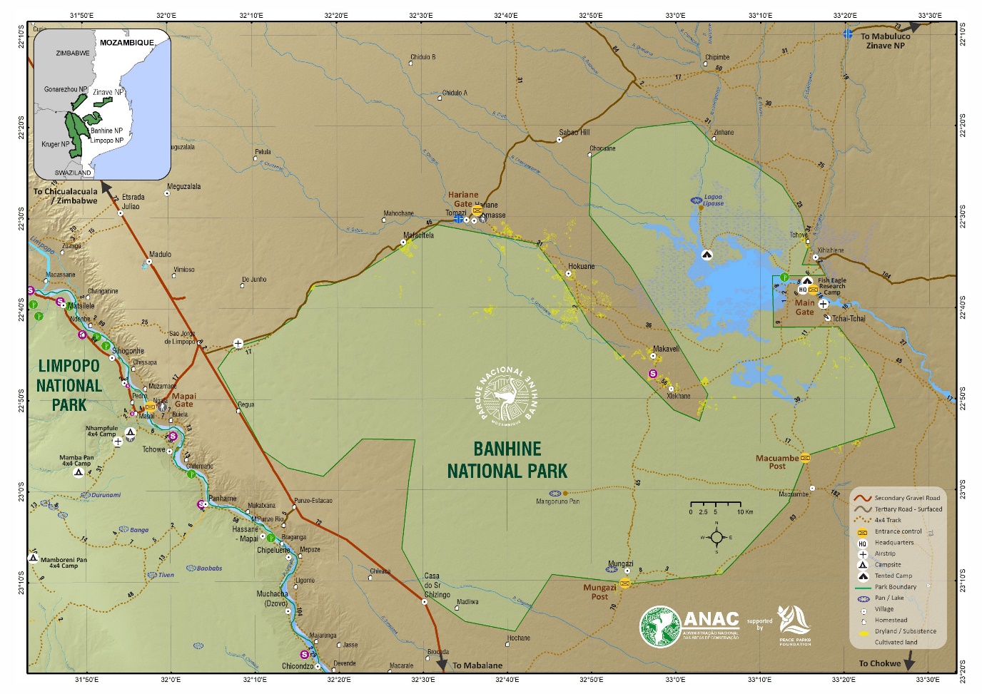
There are four official entrance gates namely: Hariane, Mungazi, Macuembe and the Head Office entrance gate where the formal camping facilities are located. There are 4 main spine road routes taking the traveller though Banhine National Park:
- Hariane Post to Xlekhane: 58km
- Xlekhane to Main Camp: 43km
- Macuambe to Main Camp: 57km
- Mungazi to Xlekhane: 43km
- Maputo to the Park: 12Hours
- Mapai to the Park: 5Hours
The Park has a sand 1,000m long Airstrip which is only suitable for light bush aircraft due to the soft sands and for which prior landing approvals are required.
GPS Coordinates
Main Gate: 22º 38’40.56’’S | 33º 14’55.884’’ E
Head office: 22º 38’40.56’’S | 33º 14’55.884’’ E
Mungazi Picket Gate: 28º8’57.85’’S | 32º54’14.98’’ E
Macuambe Picket Gate: 23º0’1.00’’S | 33º16’.00’’E
Hariane Picket Gate: 22º30’14.45’’S | 32º37’15.48’’E
Banhine Fish Eagle Tourist Camp: 22º37’58.26’’ | 33º16’2.15’’E